The Private-Land Conservation Evidence System (PLACES) is a parallelized data synthesis and collaboration platform, designed to aggregate a wide range of U.S.-wide information to the spatial unit where most land use decisions are made: the individual property.

PLACES contains data of ownership, buildings, sales, protection investments, infrastructure, demographics, geophysical characteristics, long-term land cover change, and other variables for 133 million parcels in 2,738 counties (see variable dictionary). It is developed in Python, uses only open-source packages, and is deployed on Boston University’s computing cluster.
Scalable Prediction and Hypothesis Testing
PLACES forms the backbone of our ongoing work on the human-natural dynamics of voluntary, long-term private land protection.
- We use machine learning to predict the cost of conservation for every property in the United States. Our current estimates of fair market value outperform all other proxies we found in the literature – even fair market value estimates from tax assessors (Nolte 2020 PNAS).

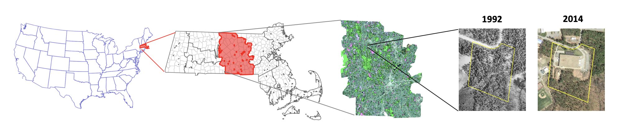
- We use causal inferential methods to estimate the social and economic impacts of private land conservation at continental scales. A pilot study in Massachusetts showed that 6,676 land acquisitions and conservation easements declared between 1985 and 2006 avoided forest loss and development without affecting land cover change on neighboring parcels.
Current Projects
We built PLACES to support diverse research projects. Below is a list of topics we are interested in. If you would like to get involved, please contact us (chrnolte@bu.edu)!
- Predicting conservation costs for different actions at large scales and high resolutions.
- Estimating causal effects of conservation interventions on land cover change and property prices across the U.S.
- Estimating the effects of Critical Habitat designations under the Endangered Species Act on property values.
- Estimating the effects of agricultural easements on avoided farmland conversion.
- Improving methods to quantify flood risk and events, and their effects on real estate markets and risk perception.
Collaboration
PLACES was designed to form bridges between social and natural scientists interested in integrating models of landowner decision making and responses of natural systems. We have supported diverse sets of analyses at the intersection of environmental economics and conservation science. If you believe PLACES data can help your research goals, find out how to get access.