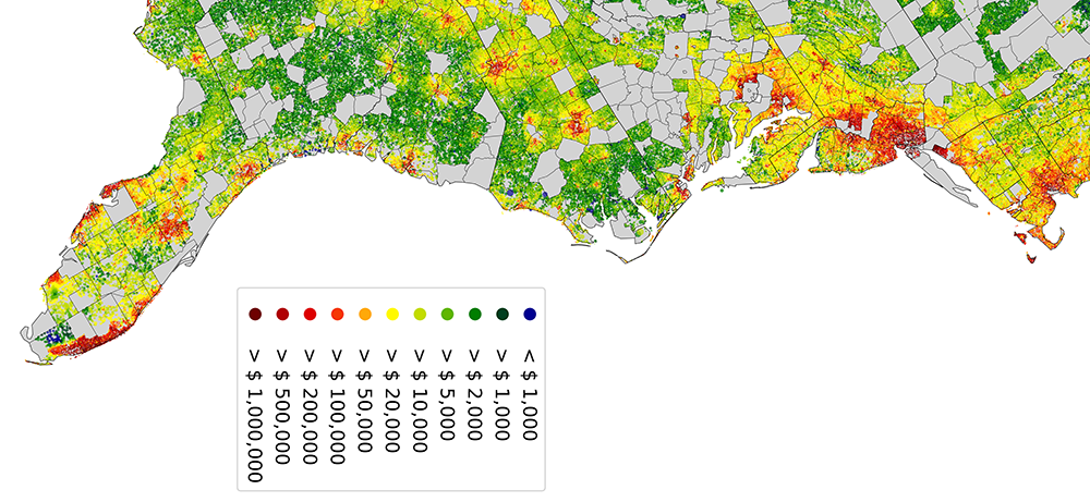
High-resolution prediction and uncertainty estimation of land value and conservation costs in the contiguous United States (NSF)
National Science Foundation, Human-Environment and Geographical Sciences, Award #2149243
Accurate estimates of the fair market value of private land rights are key inputs for many public policy choices, including property taxation and conservation planning. However, this estimation task is challenging, because land value is affected by many environmental and social factors, their importance varies geographically, and available training data of property sales tends to be scarce, clustered, and rarely representative of the landscape. This project investigates the performance of different statistical techniques to estimate land value, conservation cost, and associated uncertainties across large and heterogeneous geographical areas. The data produced in this effort are designed to support government agencies, conservation organizations, and academic research groups in the identification of conservation priorities for current and future species habitat, carbon storage, flood risk reduction, farmland protection, and equitable access to open space. The project also contributes to the education and training of a postdoctoral scholar.
With societal demand for land-based benefits shifting as a result of economic crises and climate change, an accurate predictive understanding of the trade-offs between private and public benefits from land is needed for the identification of effective and equitable policy solutions. Using a novel geospatial database of approximately 150 million properties and 4 million sales for the conterminous United States, this project compares the performance of traditional statistical estimators and modern spatial machine learning methods in predicting land values and public acquisition costs across space and time, alongside associated uncertainties. It also examines the performance of new machine learning techniques for the estimation of the value of partial land rights and conservation easements, a rapidly expanding protection instrument in the United States. In doing so, the project contributes to generalizable best practice in predictive modeling and validation of land value and conservation costs over large, nonstationary study domains.
Project Team
- Christoph Nolte (Boston University [BU], assistant professor)
- Payal Shah (research scientist, Okinawa Institute of Science and Technology)
- Katherine Anne (BU, student researcher)
- Natalia Bass (BU, student researcher)
- Ella Hinkelman (BU, student researcher)
- Gahyun Kim (BU, student researcher)
- Jack Rosenberg (BU, student researcher)
- Julianne Vaughan (BU, student researcher)
Learn more
- Explore high-resolution maps and download raster data of estimated parcel-level land value in the contiguous United States.
- Learn more about the statistical methodology, underlying data, and caveats in this research article: Nolte (2020) High-resolution land value maps reveal underestimation of conservation cost in the United States. PNAS.
